
- Sensor data recognition
- Media recognition
- Media data analysis
Road environment analysis technology using dashboard cameras
Displays the position of signs and mobile entities in the image on a map, for traffic analysis and infrastructure inspections.
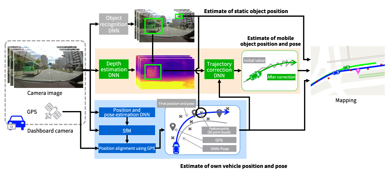
- Using images and GPS information obtained from dashboard cameras, displays on a map the movement of mobile entities (e.g., own vehicle, other vehicles, pedestrians) and the position of signs, billboards, and other road related objects.
- Uses Cloud AI to process information recorded using commercial dashboard cameras.
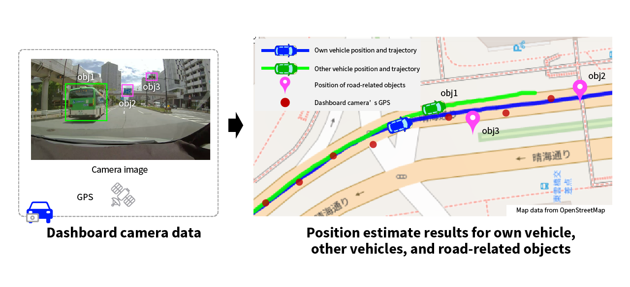
Map data from OpenStreetMap
Applications
- Analysis of traffic accidents for insurance companies
- Regular inspections and testing of road infrastructure facilities such as power lines, telephone poles, and road signs
- Support guidance in safe driving for safe driving managers
- Traffic analysis and driving diagnostics involving trucks, buses, and taxis
Benchmarks, strengths, and track record
- Uses inexpensive, easy-to-use dashboard cameras rather than specialized vehicles equipped with expensive sensors.
- Enables more accurate estimates of own and other vehicles’ positions than with existing methods.
- Link image recognition services offered by Toshiba and others and enable items of interest to users to be displayed on a map.
- Already adopted in existing products.
Inquiries
Inquiries to Toshiba Corporate Laboratory (Komukai region)
Please include the title “Toshiba AI Technology Catalog: Road environment analysis technology using dashboard cameras” or the URL in the inquiry text.
Please note that because this technology is currently the subject of R&D activities, immediate responses to inquiries may not be possible.
References:
- Atsushi Kawasaki et.al.; “Position and Trajectory Estimation of Vehicles and Roadside Equipment for Road Environment Analysis Using Dashboard Cameras” ;22nd Forum on Information Technology; (FIT), 2023
- “AI technology for analyzing accident situations from dashboard camera videos”; Toshiba Review, Vol. 78, No. 2, 2022 (in Japanese). (PDF)
- “Functions Using AI to Provide Sophisticated Services for Drivers through Analysis of Data from Edge Devices Installed in Vehicles ”; Toshiba Review, Vol. 77 No. 5, 2023 (in Japanese). (PDF)
